

Light rail station on Evergreen community connector over I-5
John Ley
For Clark County Today
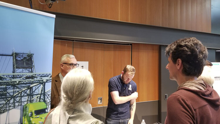
The Interstate Bridge Replacement Program (IBR) held its first community forum Wednesday (May 31) evening at the Vancouver Community Library. Citizens from around Clark County got their first up close look at engineering-type plans for the entire I-5 corridor overseen by Administrator Greg Johnson and his team. A variety of experts from TriMet to consultant engineering firms answered citizens’ questions..
Rob Rosser and a neighbor own homes on Evergreen Blvd. in historic Fort Vancouver. They were there to see the plans and possible impacts, particularly of the planned Evergreen “lid” being created over I-5. Dave Rowe, a rail transit proponent, came from Battle Ground to learn more about the light rail extension into Vancouver. Other citizens wanted to see impacts along Interstate 5 as it is widened in certain spots between the waterfront and Fourth Plain Blvd. One lady was particularly interested to learn more about tolls.
The library’s community room had a long line of people waiting for the 5 p.m. start. Tables were set up around the room with information and staff to answer questions. The IBR program is planning numerous activities throughout 2023 to seek community feedback and engage the public as part of their environmental impact review process.. Another community forum will be held on Hayden Island, June 6.
The station that gathered the most interest had a couple of long engineering type graphics of the entire project. This showed numerous details of interest including a single-deck bridge option and a double-deck bridge option. Additionally, there was an “Option A” and an “Option B” for Vancouver interchanges where SR-14 connects to I-5 and the downtown/waterfront area.
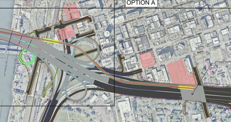
There were four or five possible park and ride locations in Vancouver, including the vacant lot just south of the library the city is in the process of purchasing. A staffer noted they could build park and ride facilities on all of them, some of them, or none of them.
Plans are for the MAX light rail station to be built on top of the new concrete lid being constructed over I-5 at Evergreen Blvd. Staff indicated they don’t have specific plans for what to do with the rest of the area of the roughly one block wide “community connector” over the interstate. “This project will not happen without light rail,” a staffer said in response to a citizen’s question.
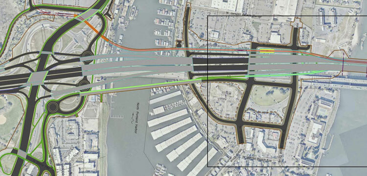
On Hayden Island and north Portland, there were specific details about the project’s plans in Oregon. Traffic going to or from Washington would use on and off ramps at the Marine Drive interchange.
There would be three main east-west roads on the island, plus a separate bridge over the north Portland harbor to the Delta Park area. Residents would use this separate bridge to get off the island instead of their current access via I-5. This would also be the path for bicyclists and pedestrians.
In total, there would be six separate bridge structures connecting Hayden Island with north Portland. One would be only for light rail. There would be two for the freeway, one northbound and the other southbound, plus two more for on and off ramps There were details of the incredible maze of roads and bridges planned for the Delta Park, Marine Drive interchange.
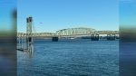
According to the plans, the main navigation channel for Columbia River marine traffic would be moved closer to the center of the river. The graphic shows five in-water piers supporting the bridge structures. One of the bridge options includes a lift span, like the present two bridges. This would be near the center of the river and provide 178 feet of clearance for marine traffic when open. Moving the lift structures to the south reduces negative impacts on Pearson Airport air traffic.
The non-movable bridge options would provide 116 feet of clearance for river traffic, The bridge would be 75 feet in elevation as it crosses the Vancouver waterfront before touching down just south of 5th Street. The waterfront transit station would be elevated above the BNSF rail line
The U.S. Coast Guard has asked the IBR for a movable bridge option. They prefer “unlimited” vertical clearance but indicate the bridge should offer at least the current 178 feet.
A new overnight light rail facility would be built just south of the Expo Center for MAX trains. A separate graphic showed the TriMet Ruby Junction maintenance facility in Gresham.
The IBR is offering two bridge options. The double deck option has light rail transit and bikes and pedestrians on the lower level, while cars and trucks are on the top level. The single deck design is much wider, with pathways for transit and active transportation on the same level as vehicles.
Later this year the IBR program will pursue federal Mega Program, Bridge Investment Program, and Capital Improvement Grant as possible funding sources. The Oregon Legislature is currently wrestling with its $1 billion funding options. Tolling could begin sometime in 2026 according to the timeline of key events.
Also read:
- Opinion: IBR program’s $13-17 billion fraud and mismanagement, perpetuated by Vancouver Mayor Anne McEnerny-Ogle and Oregon Gov. Tina Kotek
 Gary Clark argues IBR hid a $17B cost estimate from lawmakers while spending up to $280M with no public benefit.
 - Opinion: The IBR shell game for TriMet at Ruby Junction
 IBR allocates $320M for a TriMet maintenance facility 20 miles from the actual bridge project.
 - Washington and Oregon transportation commissions discuss tolling options
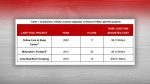
 I-5 tolls could range from $1.55 to $4.70 depending on the plan, with final rates set in late 2027.
 - Letter: ‘That is why the process matters’
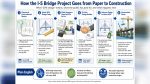 The I-5 river bridge package is at roughly 30% design, meaning final construction drawings and final price are not yet set.
 - Letter: Forty years of Democrat governors’ judicial appointments
 Tom Schenk argues 150 Democrat-appointed judges shape Washington courts with no impartial check.