

Warning is in effect until 11 a.m. Wednesday
The National Weather Service in Portland has issued a Flood Watch for the Columbia River at Vancouver affecting the greater Vancouver area. The Flood Watch warning will go into effect at 3 a.m. Sunday (June 12) and continue until 11 a.m. Wednesday.
Periods of heavy rain over the past 48 hours combined with melting snowpack in the mountains has resulted in rising river levels. Flows in rivers may increase quickly and reach critical levels. Residents and those with interests near the river should monitor rising water levels and be prepared for possible flood warnings.
Those who are in the watch area should remain alert to possible flooding. Additional information is available at www.weather.gov.
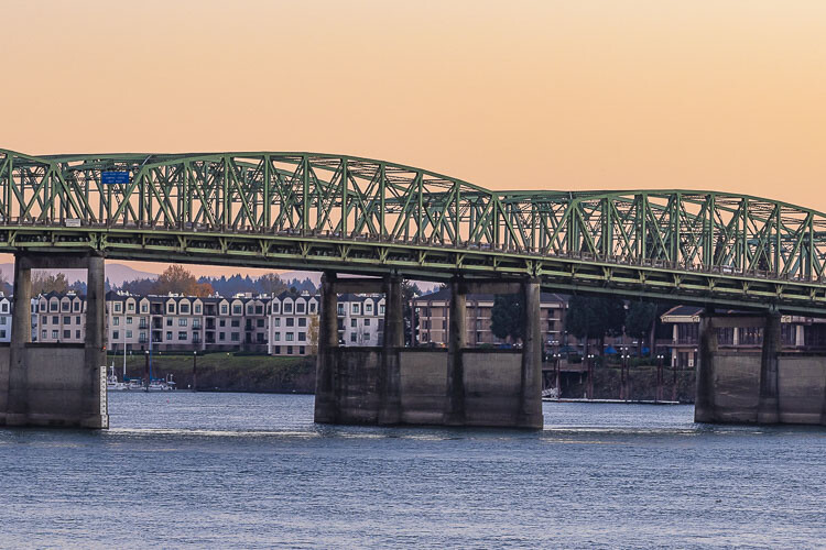
According to the Oregon Department of Transportation, travelers on Interstate 5 should expect more frequent lifts of the Interstate Bridge in the days ahead because of the increased level of the Columbia River.
The river level is expected to exceed 15 feet by early next week. The flood stage at that point on the river is 16 feet. That will mean longer lifts of the bridge spans as both upstream and downstream river traffic must use greater caution in navigating through the faster water.
The river level at the Interstate Bridge is generally six to seven feet.
Bridge lifts can sometimes be completed in six to eight minutes but lifts now are expected to last up to 20 minutes.
The increased river level has reduced the clearance at the high span, which is at the hump in the bridge at mid-river. That causes more marine traffic to use the lift span along the north side of the river. More lifts bring more delays on I-5.
Under maritime law, marine traffic has priority over I-5 highway traffic. However, no lifts are allowed during the morning and evening commute times weekdays from 6:30 a.m. to 9 a.m. and again from 2:30 p.m. to 6 p.m. except for federal holidays.
Recent rain throughout the Columbia River Basin has contributed to the high water. The Columbia River dams help regulate river volume.
The Columbia River reached the flood stage at the Interstate Bridge in 2017, when it reached 18 feet, and in 2011 when it reached 19 feet. The highest level in recent years came in 1996 when the river reached 24 feet.
The Interstate Bridge is jointly owned by Oregon and Washington and is operated and maintained by ODOT. The northbound span opened Feb. 14, 1917 and the southbound span July 1, 1958.
Also read:
- POLL: Do patriotic displays like Yacolt’s road striping help strengthen community spirit?
 A Yacolt road striping project tied to America’s 250th anniversary is dividing opinion in Clark County.
 - Opinion: The challenges of getting the Brockmann mental health facility open
 A $42 million, 48-bed mental health campus near WSU Vancouver was completed in 2025 but never opened due to lack of state funding.
 - Parents call for resignation of Longview School Board amid sex assault investigation
 Superintendent Karen Cloninger faces felony witness tampering charges tied to a student sex assault case at Mark Morris High School.
 - Opinion: Washington’s business exodus accelerates due to high taxes, regulations driving companies away
 Washington’s business relocation rate has nearly tripled since winter 2025, per an AWB survey.
 - County’s Charter Review Commissioners available to meet with community groups
 Fifteen elected commissioners are seeking public input on possible amendments to Clark County’s home rule charter before an Aug. 4 submission deadline.
 - David Kuhnhausen selected as county’s Community Development director
 David Kuhnhausen spent nearly two decades at the city of Portland before taking the Clark County role.
 - OII investigating non-fatal use of deadly force that occurred in Vancouver Tuesday
 OII’s investigation marks the first non-fatal use of force case it has taken on since December 2024.