

Forty-six years after the eruption, Mount St. Helens remains one of the Pacific Northwest’s most unforgettable destinations
Editors note: content from this story was originally published on August 13, 2019.
COUGAR — On the morning of May 18, 1980, a mountain in the Cascade Range of southwest Washington became the most famous volcano in the continental United States.
Mount St. Helens erupted following a 5.1 magnitude earthquake that triggered a massive landslide, tearing open the mountain and releasing pressurized gas and ash from inside the volcano.
The eruption sent an enormous ash cloud outward and high into the atmosphere. More than 150 square miles of forest were blown down or scorched. Fifty-seven people lost their lives, while homes, bridges, highways, and railways across the region were destroyed.
In 1982, Congress established the Mount St. Helens National Volcanic Monument, creating a landscape where visitors could learn about the eruption, recovery, and ongoing volcanic activity surrounding the mountain.
Today, Mount St. Helens continues to attract visitors from across the Pacific Northwest and beyond. From scenic viewpoints and visitor centers to hiking trails and educational exhibits, the area offers one of the region’s most unique day trip destinations.
This edition of Pacific Northwest Day Trips revisits some of the stops and experiences that continue to make Mount St. Helens one of Washington’s most remarkable places to explore.
Visitor Alert: South Coldwater Slide
Visitors planning a trip to Mount St. Helens should be aware that access to some areas near Johnston Ridge Observatory remains affected by the South Coldwater Slide, a large landslide that damaged a section of State Route 504 in 2023.
The slide occurred between the Coldwater Lake area and Johnston Ridge Observatory, cutting off vehicle access to the observatory and nearby trail systems beyond the closure point.
According to the U.S. Forest Service, Coldwater Lake and many destinations along Spirit Lake Memorial Highway remain open to visitors, including viewpoints, trails, and recreation areas located before the closure area. Johnston Ridge Observatory remains inaccessible by vehicle at this time.
More information: South Coldwater Slide Information
Here are our favorite spots within the Mt. St. Helens National Volcanic Monument and beyond:
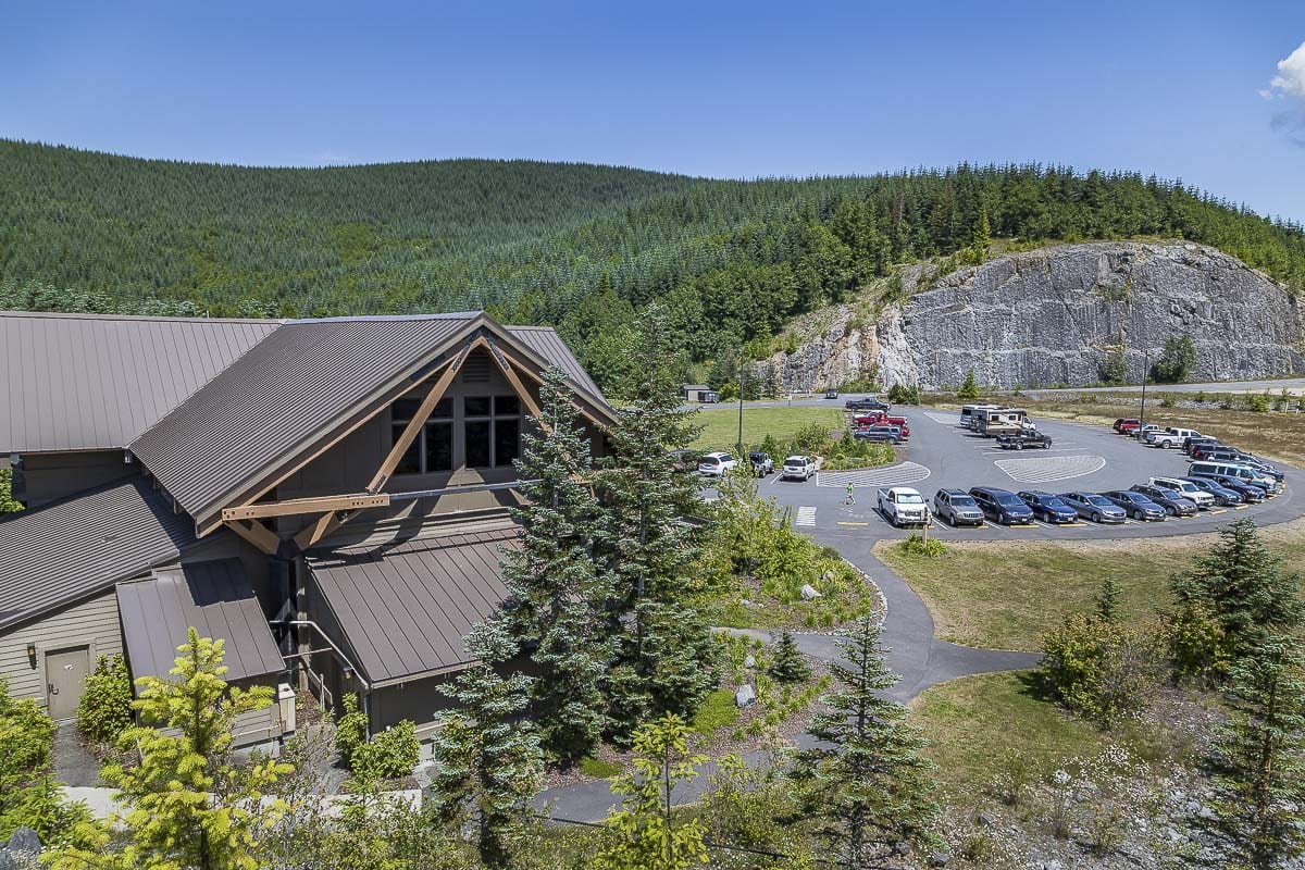
1. Mt. St. Helens Visitor Center at Silver Lake
2. Forest Learning Center by Weyerhaeuser

- Located inside the blast zone, off the Spirit Lake Memorial Highway
- The center is maintained through a partnership of Weyerhaeuser, WSDOT and the Rocky Mountain Elk Foundation
- The center showcases the recovery process for the forests surrounding the volcano
- Outside is a large interactive children’s play area, viewing platforms for the mountain and a viewing platform for elk spotting
- Inside, a theater and full-size exhibits featuring animals and trees fills the building
- Kids activities and models of the region are scattered throughout the center
3. Fire Mountain Grill at the 19 Mile House
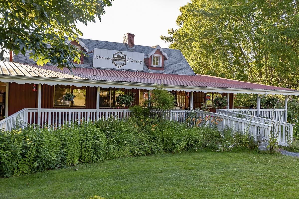
- The only true restaurant on the way to the mountain, Fire Mountain Grill features Americana cuisine and famous fruit cobblers
- The building is historic and maintains a wrap around deck with views of the Toutle River below
- Outfront, there is also a large Weyerhaeuser logging truck from 1980 that was totaled in the blast; it now has a tree growing through it
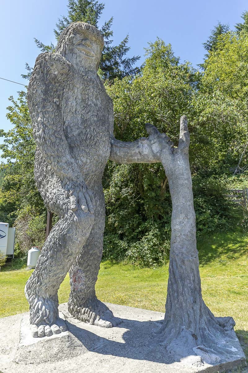
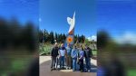
4. Buried A-Frame and Bigfoot Statue
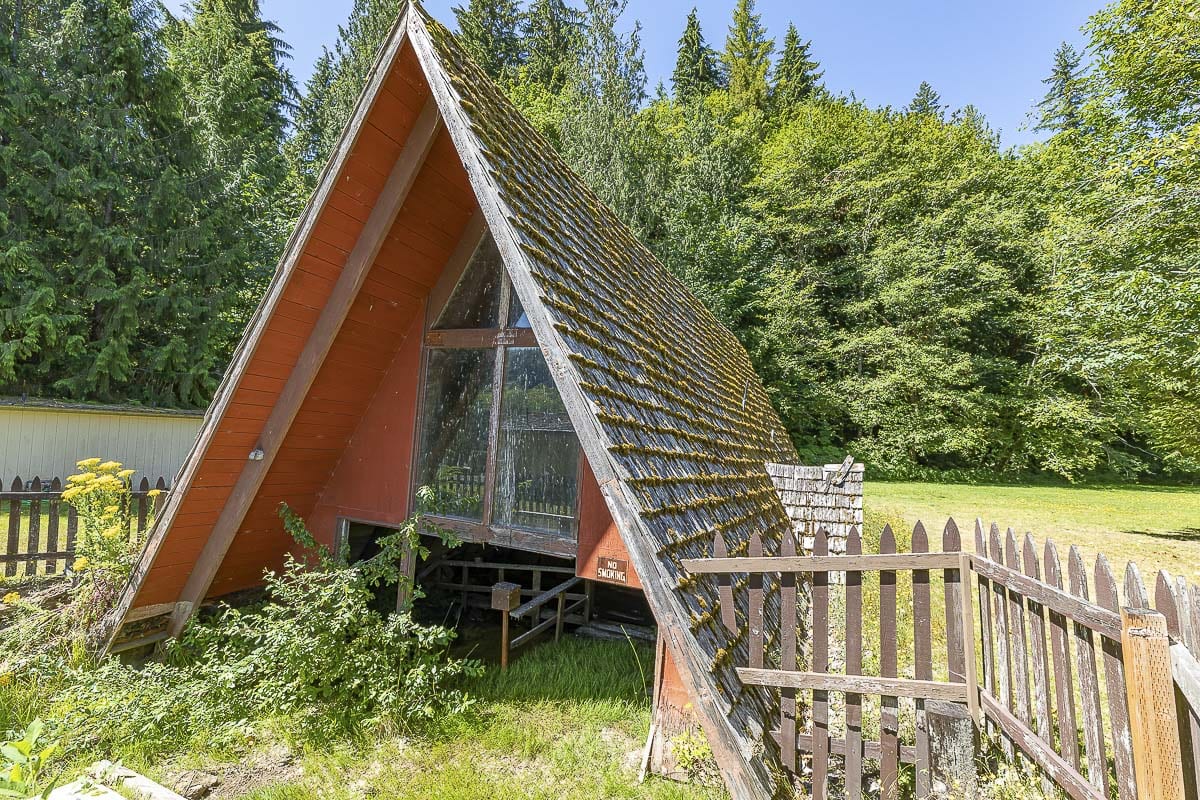
- The half-buried A-Frame home is another historic stop on the way up, although you can no longer walk thru it
- Refreshments and supplies are available for purchase at two small stores nearby, and helicopter tours of the valley also take off for here
- The original bigfoot statue was destroyed in the 1980 eruption, and is now replaced with a larger, concrete version
5. Coldwater Lake Picnic and Boating Site
- The lake was actually created by the eruption, when mudflows constructed and blocked Coldwater Creek
- The lake shines a brilliant blue, and is safe for swimming, fishing and boating
- A boat launch is available to visitors, as well as a picnic area with tables and a restroom with running water
6. Elk Rock Viewpoint, Castle Lake Viewpoint, and Loowit Viewpoint
- These three viewpoints are in sequential order going towards the mountain, and each feature a stunning yet unique view
- The are dotted nearly equidistant from each other over 14 miles of Spirit Lake Highway; just before Johnston Ridge Observatory
- Each offers parking and a safe area to view and take photos of the mountain and Toutle River Valley
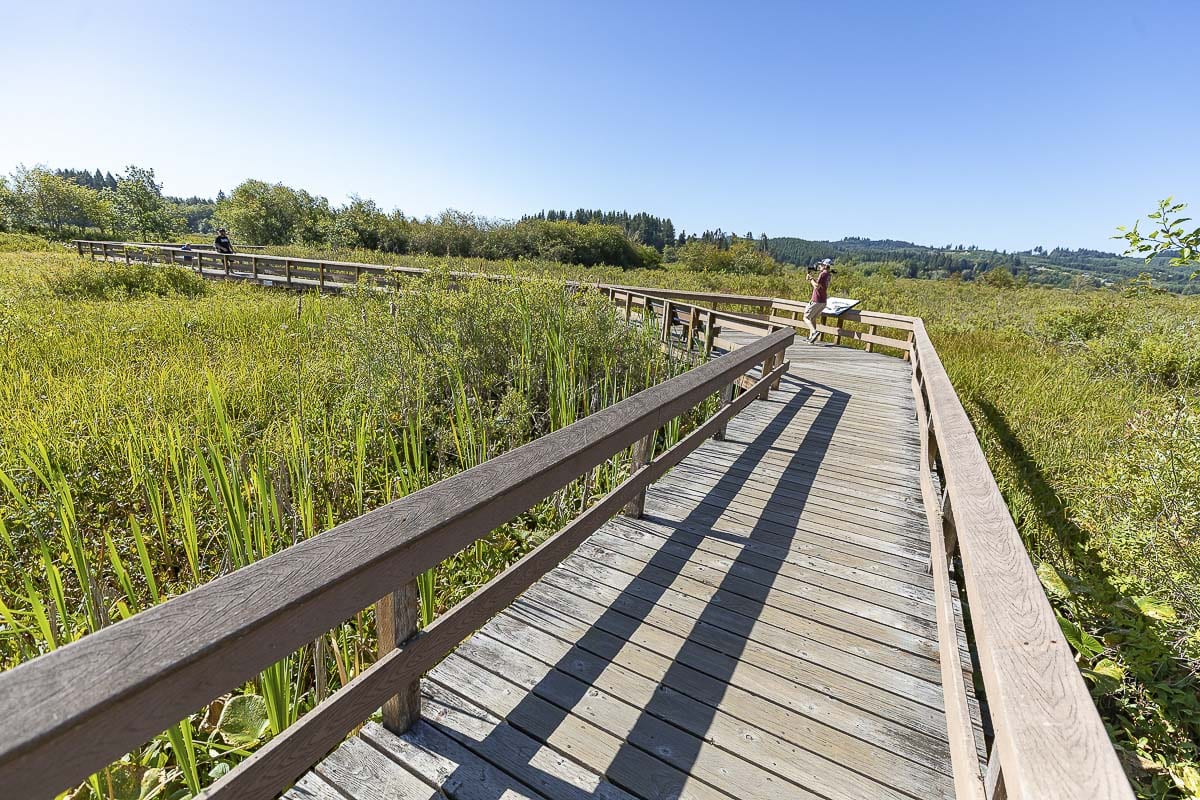
7. Hummocks Trail #229
- Hummocks are, in fact, large pieces of Mt. St. Helens, hurled miles down the Toutle River Valley
- Now hills, the hummocks create miniature valleys, which this trail winds through
- The hike lasts several miles, but is easy in incline and has many beautiful forested points with views of the mountain
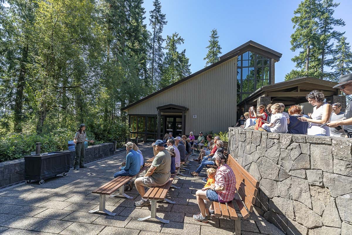
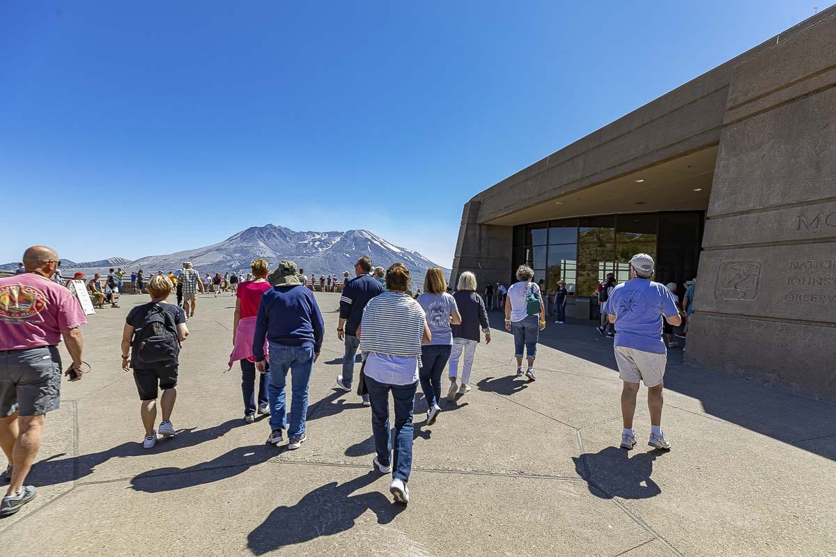
8. Johnston Ridge Observatory
Road Closure Notice
Upper State Route 504/Spirit Lake Memorial Highway is closed between mileposts 45.2 and 51 until further notice, with a possible reopening sometime in 2026.
The road is currently blocked just outside the Hummocks Trailhead at the normal winter closure gate.
Johnston Ridge Observatory and Loowit Viewpoint are inaccessible by vehicle, and the visitor center is closed to the public.
More information: Upper State Route 504 Closure Information

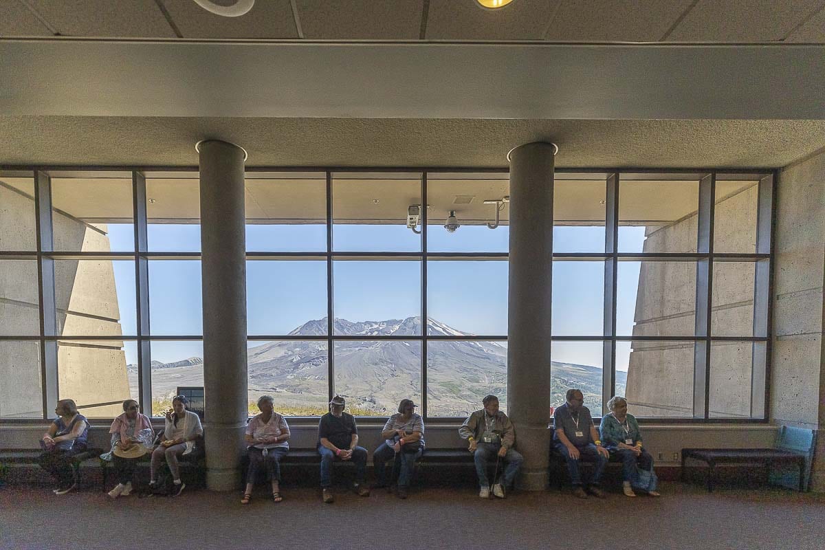

- Named for the late volcanologist, David A. Johnston, who lost his life in the 1980 eruption while studying the mountain
- The observatory is the epicenter of all things Mt. St. Helens: research, measurements, studies, views, exhibits, trails, etc.
- A large parking lot also features a small food cart which is open sporadically
- Up a somewhat steep walkway, you will find the observatory itself, with the main overlook of the volcano’s horseshoe-shaped crater
- Inside the main building there are large scale models of the surrounding topography, as well as broken trees, a seismograph, a large scale theater playing a documentary, and more
- Outside, to the east, there is an outdoor amphitheater constructed in 2012, for presentations, concerts and viewing
- Connected to the observatory is a network of trails leading up the ridge and closer to the mountain
Also read:
- Letter: ‘That is why the process matters’
 The I-5 river bridge package is at roughly 30% design, meaning final construction drawings and final price are not yet set.
 - Letter: Forty years of Democrat governors’ judicial appointments
 Tom Schenk argues 150 Democrat-appointed judges shape Washington courts with no impartial check.
 - Work begins this month to improve intersection at Northeast 182nd Street and Risto Road
 A new single-lane roundabout replaces the existing intersection at Northeast 182nd Avenue and Risto Road starting June 22.
 - Community attends ribbon-cutting event to celebrate new Curtin Creek Community Park
 Curtin Creek Community Park opened with a ribbon-cutting, decades after the land was first purchased in 1999.
 - It’s an early morning for those who participate in the annual Junior Market in Vancouver
 175 booths and 300 small businesses, all run by teens and children, filled Esther Short Park for Lemonade Day Junior Market.
 - Clark County Sheriff’s Office investigating deadly stabbing in Battle Ground
 A man died and a woman was hospitalized after a stabbing near NE 117th Ave and NE 244th St in Battle Ground.
 - Charter Review Commission members grow increasingly frustrated with overreach by county executives
 Commissioners Donnelly, Gasque, and LaBrant accused county staff and Auditor Kimsey of tilting the charter amendment process.