

Cold air expected to meet precipitation after sunset Wednesday, with the potential for more snow and certainly freezing temperatures on Thursday morning
Paul Valencia
ClarkCountyToday.com
Wednesday morning’s burst of snow in Clark County that led to the closure of some school districts might just be a preview of more snow overnight into Thursday morning.
Weather forecasters throughout the Portland-Vancouver television market noted that this storm has been tricky to forecast.
However, parents and students should be prepared for the potential for more school closures on Thursday.
Commuters should plan for extra time on the roads, stay home if they can, or head into work later than usual on Thursday.
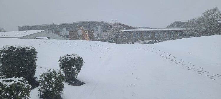
Many school districts originally opted for a two-hour delay on Wednesday morning but quickly changed to calling off school all day in Battle Ground, Camas, Green Mountain, Hockinson, La Center, Ridgefield, Washougal, and Woodland.
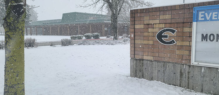
In east Vancouver, snow started sticking near Evergreen High School a little later in the morning. Buses were already picking up students. The snow arrived even later in downtown Vancouver. By around 11 a.m. it was not sticking on the roads in the downtown area. Evergreen Public Schools and Vancouver Public Schools were on normal school hours.
The tricky forecast, though, leads some to think that all school districts in the region will be affected by Thursday morning.
According to Steve Pierce of KOIN 6 News, models indicate between a dusting and 4 inches of snow could fall across the region beginning just after sunset Wednesday and through Thursday morning.
“By sunrise on Thursday morning, the metro area will be solidly frozen with snowfall likely on the ground,” Pierce wrote on a Facebook post.
Snowfall is likely to be done by sunrise, but anything on the ground by then will be frozen. Temperatures will “struggle” to get into the 30s on Thursday afternoon, with low temperatures overnight Thursday and into Friday dropping into the teens, Pierce reported.
The National Weather Service also has a wind chill advisory in effect from midnight Wednesday (Thursday a.m.) until Thursday at noon.The wind chill, according to the NWS, could go below zero.
Weather forecasters noted on television broadcasts Wednesday morning that the models that predict snowfall have not been consistent. Some suggest just a trace for the lower elevation spots. Others say the metro area could get a little more than 4 inches.
Wednesday morning’s snowfall was also difficult to predict. Forecasters said show showers would taper off in the morning and that the temperature would rise to 40 degrees by noon. In east Vancouver, the snow was still falling at 11:30 and it was 33 degrees near Evergreen High School.
C-TRAN services have also been impacted by Wednesday’s snow. C-TRAN sent a press release at 10:45 a.m. Wednesday noting that:
- Route 19 is currently on snow route and service to WSU Vancouver is temporarily suspended.
- The Current is temporarily unable to serve the Prune Hill area in Camas.
- Route 47 is canceled for today.
- Route 92 is operating on a snow route.
- The Vine-Fourth Plain is using 40′ buses. Passengers should board where adverse weather signs are posted on each platform.
Visit C-TRANS’s website for any more updates.
Also read:
- Clark College officially opens Advanced Manufacturing Center in Ridgefield
 Clark College marked the official opening of its Advanced Manufacturing Center in Ridgefield, a new facility focused on training students for careers in advanced manufacturing.
 - POLL: With updated estimates reaching as high as $17.7 billion, what should happen to the I-5 Bridge replacement project?
 A new poll asks readers how the I-5 Bridge replacement project should proceed amid higher cost estimates and questions about transparency within the Interstate Bridge Replacement Program.
 - Letter: ‘Walz’s tough talk is a blatant attempt to deflect his complicity in the massive fraud in his state’
 Camas resident Anna Miller argues that a governor has no legal authority to deploy the National Guard to interfere with federal law enforcement and criticizes Minnesota Gov. Tim Walz’s public statements.
 - VIDEO: Reykdal tells school districts to ‘abide by the law’ on trans athletes
 State Superintendent Chris Reykdal said Washington school districts must follow state law on transgender athletes as citizen initiatives and related Supreme Court cases move forward.
 - County seeks community needs survey responses from residents
 Clark County Community Services is collecting survey responses from residents living on limited incomes to inform its required Community Needs Assessment and guide funding priorities for anti-poverty services.
 - Opinion: Not a Good choice
 Lars Larson argues that personal choices led to a deadly confrontation with law enforcement during an ICE operation in Minneapolis.
 - County Charter Review Commission to hold first two meetings in January
 The Clark County Charter Review Commission will meet twice in January to begin reviewing the county’s charter and consider whether to recommend amendments for voter approval.