

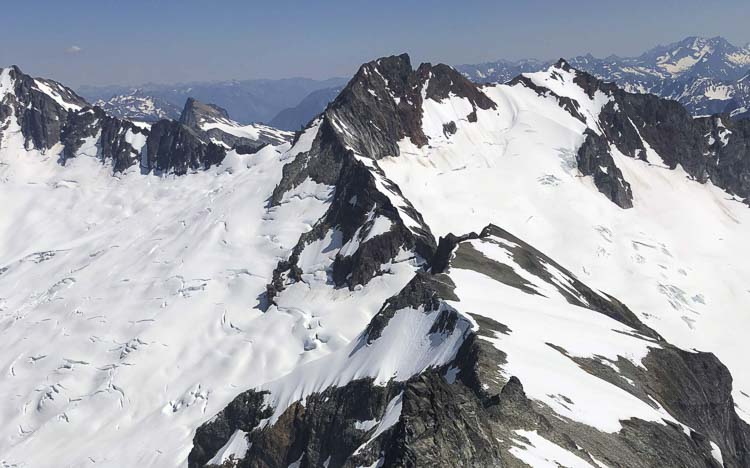
Snowpack in the Northwest is sitting at the lowest level for the region as a whole at this point in the winter since record keeping began in 2001
Alex Baumhardt
Washington State Standard
Across the Northwest, a record warm fall and lack of snowpack going into the winter is putting more drought pressure on Oregon, Idaho, Washington and western Montana.
Despite record rain in western Washington recently, and earlier this year in central and southern Oregon, the showers are filling up already overdrawn reservoirs in many areas, scientists said on Monday at an online drought and climate outlook meeting hosted by the National Oceanic and Atmospheric Administration.
Snowpack in the region and in the Cascade Range, acting as a reservoir of its own for summer months when there’s little rain and many communities rely on snowmelt, is simply not piling up.
Snowpack in the Northwest is sitting at the lowest level for the region as a whole at this point in the winter since record keeping began in 2001, according to Jacob Genuise, a climatologist at the Washington State Climate Office.
“We’re seeing just really warm storms with a lot of rain and not a lot of snow,” Genuise said. “Given all this warm rain, it actually melted some of our snowpack, and we saw a decline.”
The Northwest just experienced its sixth warmest August on record, the warmest September on record — about 6 degrees Fahrenheit above normal on average — and the second warmest November on record, according to NOAA data.
Taken together, August through November of this year was the record warmest on average across the Northwest in more than 130 years of record keeping. NASA scientists, using NOAA records of global average temperatures dating back to 1880, found that this November was the third-warmest November on Earth, behind only November of 2023 and 2024.
But in 2023 and 2024, a planet-warming El Niño weather pattern helped fuel record temperatures, according to the data. There was no El Niño event to drive temperatures this year.
Temperatures in the Northwest have been most abnormal across all of Idaho, eastern Washington and eastern Oregon, and in western Montana.
“It’s definitely not good,” Genuise said. “We’ve seen much more above normal years in the past few decades than we did in the past.”
Rain not snow
By the end of this summer, drought took hold of the Northwest, Genuise said, especially in parts of northern Idaho and southeast Washington. Snow melted too quickly in spring, creating drought as the summer went on, and abnormal heat also increased surface water evaporation in lakes and streams, lowering water levels that contributed to drought in parts of the region.
In the last month, most of western Oregon was at 50% of its normal level of precipitation for this time of year, according to Brad Pugh, a meteorologist at the National Weather Service’s Climate Prediction Center.
Only southern and central Oregon have been spared major drought impacts this year, but reservoirs that filled from heavy spring rains are also being quickly depleted, he said.
Everywhere north of Oregon is experiencing above average rainfall, Pugh said.
This will potentially help pull the Northwest out of a region-wide drought in the coming weeks or month, according to Pugh, but much of that will also depend on whether or not it gets cold enough for rain to turn into snow and snowpack.
The only area in the region getting roughly normal snowpack is western Montana, where temperatures have been just-cold-enough to turn rain to snow. All of Oregon and most of southern Washington are seeing “really, really deep snowpack deficits,” Genuise said.
If the snowpack is still bad in the spring, there could be ongoing drought issues in the year ahead, Genuise added.
“We could see this change, and this is likely to change as we see some wetter and cooler systems later in the month, but we’re definitely sitting well below normal as we talk here today,” he said.
This story was originally produced by Oregon Capital Chronicle, which is part of States Newsroom, a nonprofit news network which includes Washington State Standard, and is supported by grants and a coalition of donors as a 501c(3) public charity.
Also read:
- Vancouver Fire Department responds to emergency aircraft landing on SR-14
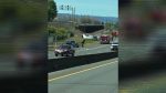 A Cessna aircraft made an emergency landing on State Route 14 near milepost 2 after experiencing mechanical issues.
 - Vancouver Police investigate shooting
 Vancouver Police seek suspect after 20-year-old shot in SE Mill Plain parking lot early Saturday morning.
 - Dollars flowing into a pair of hotly contested WA congressional races
 Amanda McKinney leads 4th District GOP field with $523,892 raised, while Braun trails significantly behind incumbent.
 - Final Supplemental Environmental Impact Statement published for Interstate Bridge Replacement Program
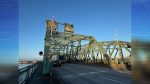 Federal agencies published the final environmental impact statement for the Interstate Bridge replacement project.
 - Belkot appeals judge’s decision to dismiss her case against Clark County
 Belkot’s attorney says the federal appeals court will hear the case in several months after judge dismissed all five claims.
 - Union baseball, softball teams honor military, veterans, and first responders
 Baseball and softball teams combined efforts to recognize military heroes and first responders with ceremonial pitches.
 - Union baseball, softball teams honor military, veterans, and first responders
 Baseball and softball teams combined efforts to recognize military heroes and first responders with ceremonial pitches.