

The Department of Natural Resources says crews will focus on saving any structures that might be threatened by the fire
CHELATCHIE — People living in the shadow of the Big Hollow fire burning southeast of Cougar will be relieved to know the flow of information should improve soon.
In a post on Thursday afternoon, the Department of Natural Resources said a Type 2 incident management team would be arriving early Friday morning to take over command of the fire, which has burned more than 12,000 acres in the Gifford Pinchot National Forest, south of Swift Reservoir in the Trapper Creek Wilderness.
The fire has put residents in Cougar, Chelatchie, Yacolt, and Amboy on edge.
A level 2 evacuation warning was issued for areas including Chelatchie, north to the Skamania County line, and expanded into Cowlitz County on Thursday to include Cougar and Yale. A level 2 warning means “be ready,” which includes having things packed in case you’re ordered to leave.
Amboy and part of Yacolt are under a level 1 warning, which means “be alert.”
DNR said Thursday evening that people in and around Yale Reservoir will begin to see an influx of additional firefighting resources through tomorrow morning. Crews are working on the western and northern fronts of the fire, developing structure protection plans in the event they are needed.

In addition to the Area Closure that was issued for a southwestern portion of the Gifford Pinchot National Forest, DNR Recreation in the DNR Siouxon Block and Merrill Lake area has also been closed due to the fire and evacuation notices. This includes recreation trails, campgrounds, and dispersed camping, and day use areas on those DNR managed lands.
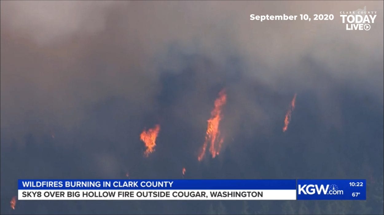
The fire, which was first spotted Tuesday morning, has been burning in heavy timber. Video obtained by KGW.com and Sky 8 on Thursday showed dense smoke and flames climbing a hill in the area.
DNR says most of the Big Hollow fire growth happened on the southwest perimeter Thursday, however that growth has slowed compared to the previous 48 hours.
Weather conditions are expected to be in favor of keeping the fire largely contained. East winds that had buffeted the area since Monday have largely died down, shifting to a southeasterly flow that will bring cooler air into the region over the weekend, and a possibility of rain early next week.
Those winds could present health risks for people with lung conditions, however. Satellite imagery from NASA and the National Oceanic and Atmospheric Administration show massive plumes of smoke out over the Pacific Ocean. The shifting winds are expected to bring much of that smoke back inland by Friday, potentially creating hazardous air quality conditions in much of the Willamette Valley area.
