

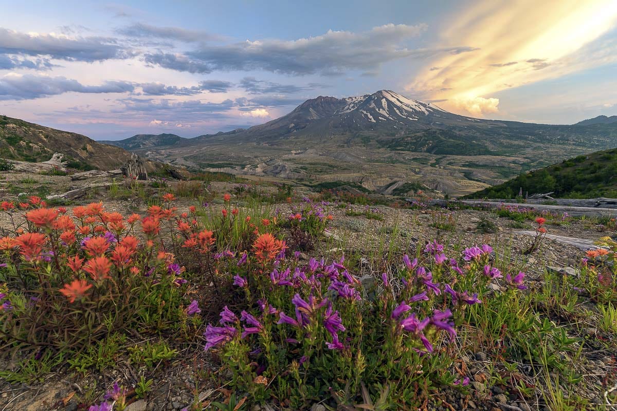
The mountain’s May 1980 eruption was international news for weeks
CLARK COUNTY — If you lived in the Pacific Northwest in 1980, and you were old enough, you likely still have vivid memories of the moment Mt. St. Helens erupted.
President Jimmy Carter, upon visiting the site, was quoted as saying, “someone said this area looked like a moonscape. But the moon looks more like a golf course compared to what’s up there.”
We asked the Clark County Today staff for their memories. Editor Ken Vance, who lived in the area at the time, was actually on a road trip with some friends to California when the mountain blew.
His parents thought they were at the coast. But that’s another story.
Administrator Heidi Wetzler remembers it this way:
“My parents moved our family to Battle Ground in January 1980 after purchasing a weekly newspaper there. It was a small town at the time with a population of 2,000 give or take. I remember it being well known that Mt. St. Helens was waking up in the months leading up to the eruption. One memory that sticks with me is the story of a man named Harry R. Truman, the owner and operator of Mount St. Helens Lodge. He refused to evacuate his home and business at Spirit Lake near the foot of the mountain despite repeated attempts to persuade him that he was in imminent danger. He was 83 years old. I remember feeling horrified and confused at his steadfast will. I couldn’t understand how he wasn’t scared.
“There was a lot of talk as to whether it would erupt or not, but then as we know, on Sun., May 18, it did. It was a clear-sky sunny morning. My whole neighborhood was outside, looking. I could barely believe I was so close to an event that the whole world was talking about. Somehow, I don’t remember feeling afraid. My parents must be responsible for that. I remember riding my bike to my elementary school and taking pictures with my little camera.
“Then the ash came. It covered everything. It was fine and light and impossible to clean. I remember my dad, along with other men, using firefighter hoses to spray down city streets. I remember my school being closed for a few days in order to clean the playground and make it safe to return. I remember wearing a handkerchief around my face and walking to the neighborhood burger joint with my family. I remember feeling quite brave doing that. I was 8 years old.
“Harry R. Truman died the day of the eruption, buried under a pyroclastic flow that consumed his lodge. I still get chills thinking of his story. He knew that staying in his home meant that he would perish on that mountain. Was he courageous, or crazy, or both? One thing is for sure. He knew he’d rather die on that mountain, than be forced to live anywhere else.
“I feel lucky to have been an eyewitness to this historic day. It is hard to believe it’s been 40 years.”
Clark County Today photographer and videographer Mike Schultz was a young, aspiring photographer at the time, and recalls the excitement that built ahead of the big eruption.
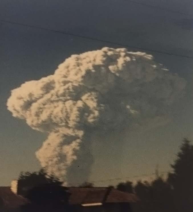
“I was 15 years old and Mt. St. Helens had awakened from a long slumber in March 1980. This was a very exciting time for a kid who was interested in geology. Over the next two months, the mountain erupted with small ash and steam eruptions. In April, a bulge started to grow up to five feet per day on the north side of the mountain, and it continued to grow until it finally gave way on May 18.
“On that Sunday morning, I was cooking breakfast and breaking down camp at Camp Currie on Lacamas Lake during a boy scout camping trip. We got word of the mountain erupting, so I turned on my radio. I couldn’t quite get a grasp of the enormity of the eruption from the radio. I knew it was big but didn’t know how big until we started the drive back home to Battle Ground. When our car rounded the corner in Hockinson it became clear that this was a major event.
“During that surreal day, my family went to view the eruption north of Battle Ground. I will never forget watching through binoculars the pyroclastic flows racing down the west side of the mountain. The plume of ash was towering over the mountain. The real shock came from seeing the true devastation on television as the trees and mud flows traveled down the Toutle River valley, wiping out everything in its path. Logging camps, homes, livestock, bridges and trees. All gone. In all, 57 people lost their lives that day. The summit and entire north face of the mountain was gone. It would be days and weeks before we really knew how bad the damage was.
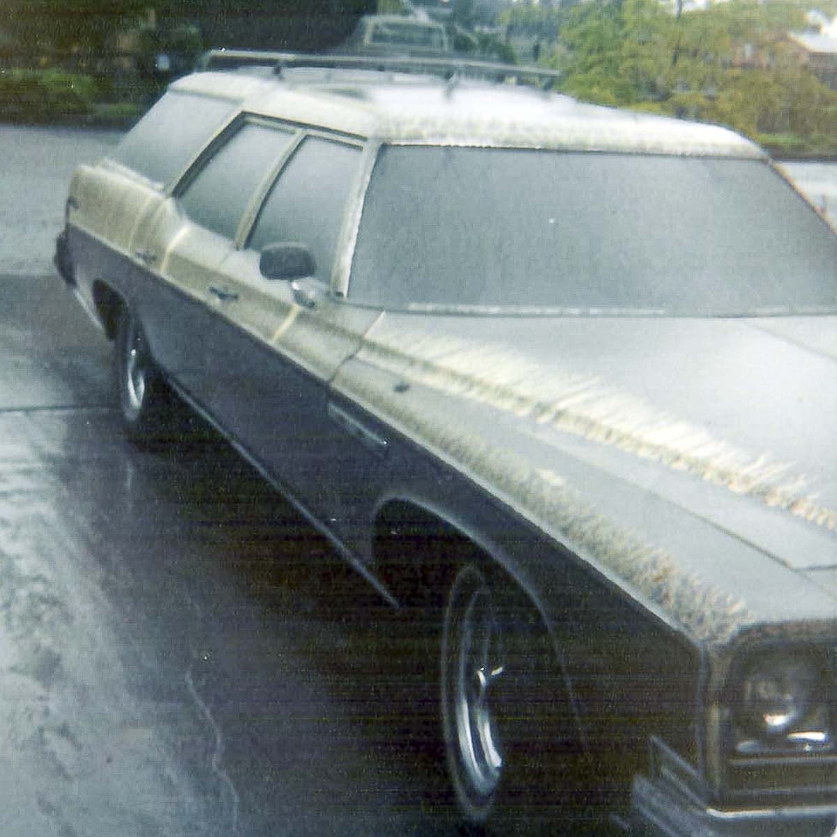
“While Clark County was spared the ash fall from May 18, we were not so lucky on the May 25 and June 12 eruptions. I was living in Battle Ground at the time and we received a good coating of ash on both dates during rainfall. For weeks following, we had to hose off sidewalks, driveways, parking lots and roofs. Gutters had to be cleaned out to prevent them from falling off houses from the weight of the ash.
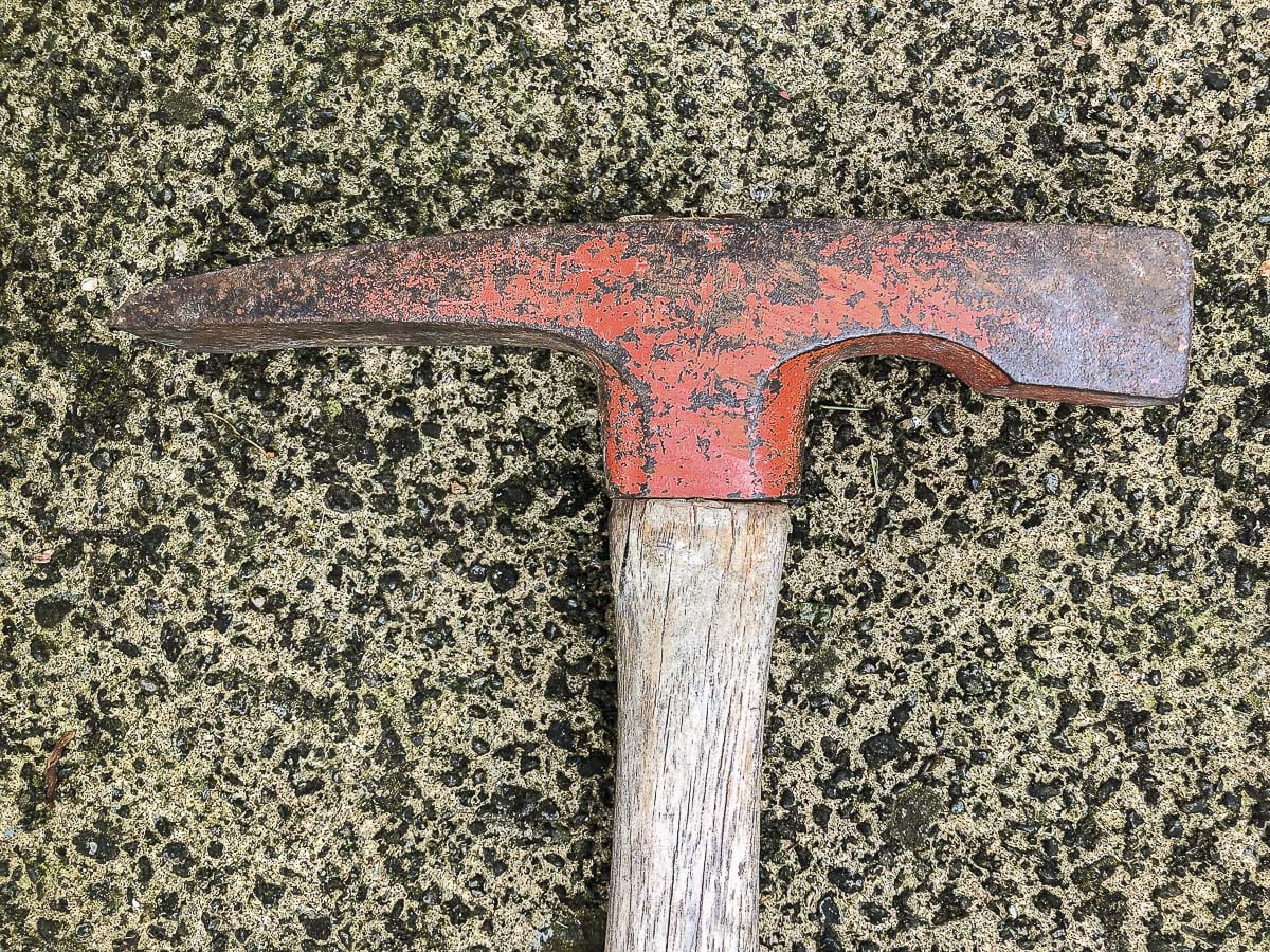
“In July 1981, I had the opportunity to go with U.S. Forest Service photographer Francisco Valenzuela into the restricted red zone around the active volcano. At only 16, my parents had to sign a waiver holding the forest service free of liability. We traveled to the west side of Mt. St. Helens above the south fork of the Toutle River. We had to walk down a steep hillside carrying heavy 4 x 5 camera equipment for more than a mile, over and under blown down trees to get to the river. Once we arrived at the river we walked out to a spot, drove a stake into the ground and set up an official photography landmark. Photographs would then be taken from this spot every year. I had my brand new Pentax K1000 camera and got to take some pretty neat photos that day. I also found a rock hammer partially buried in ash near the Toutle River. I still don’t know if it was left there before the eruption or after the eruption. I was fascinated that, after only 14 months, there were plants and flowers growing and blooming out of the ash.
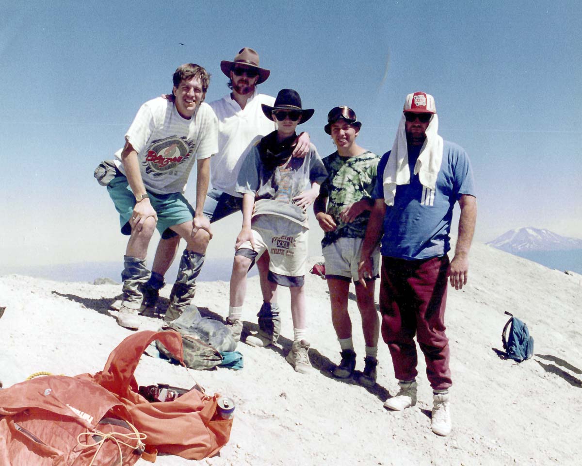
“I have photographed, hiked, camped and climbed Mt. St Helens over the years and this mountain has always had a special place in my heart.”
Thanks to Heidi and Mike for sharing their stories. Feel free to post your own memories of Mt. St. Helens’ eruption in the comments below.
In a post about the eruption on the US Geological Survey’s Facebook page, dozens of people, from as far away as Connecticut, have shared their stories. The ash plume that went up from Mt. St. Helens rained down hundreds of miles away, leaving a geological record still being studied by scientists 40 years later.
And, it appears, the volcano known to the Klickitat tribe as Louwala-Clough, which means “smoking or fire mountain,” is not done yet. Geologists say there is evidence the mountain remains highly active.
